Monday, October 04, 2010

Early October Light

Early in October I found a small flock of Cattle Egrets foraging with the sheep at the farm on Clark Road.
CattleEgretsClarkSheep10-04-2010JGWard_MG_6337

CattleEgretClarkSheepFarm10-_MG_6302

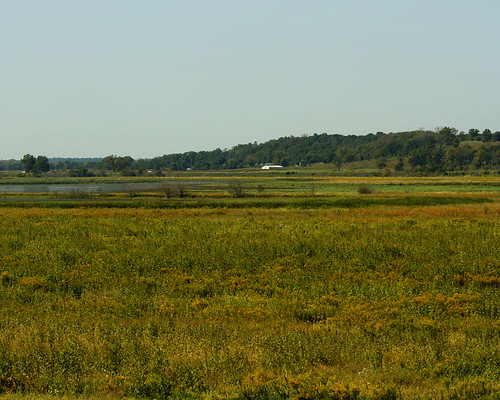
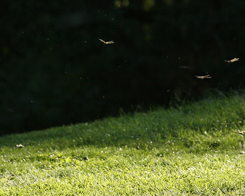
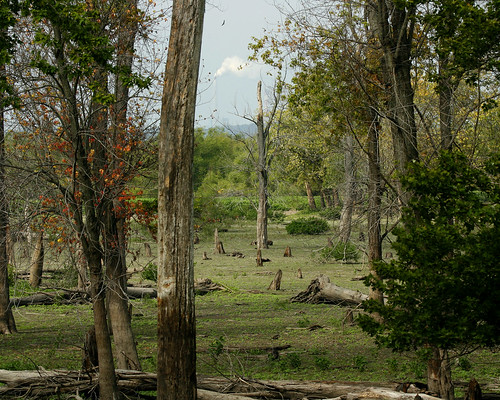
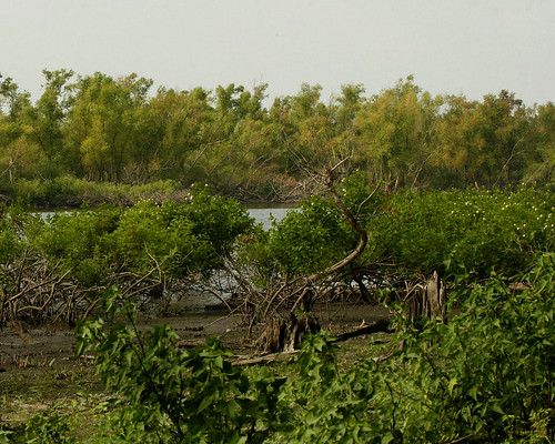
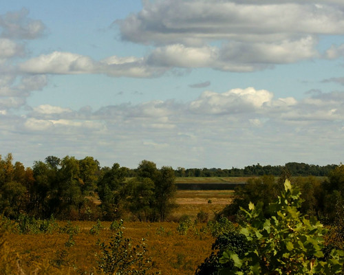
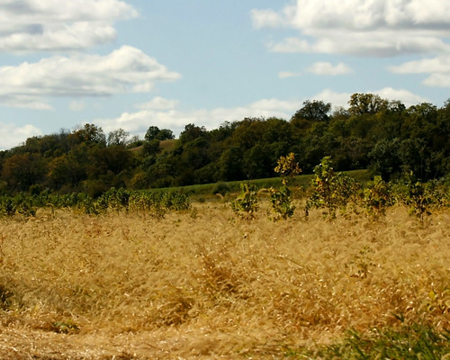
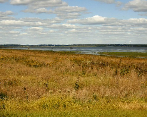
I headed on out to the path leading to the levee. The light was fantastic, with blue sky and billowing clouds. The wet prairie awaited. I took a photo of the prairie from the road, where I parked my car. I could see all the way to the northern levee. The palette of colors changing with the variuos habitats was subtle and vibrant in the morning light.
ClarkRoadPathwayNorthLevee10042010JGWard_MG_6357

As I walked down the path, I looked back towards the bluff through a sea of Foxtail grass with the young trees planted by TNC poking their branches up through it. This is an affect of foreshortening caused by the 100mm lens, but it is a neat affect. The highway in front of the tree covered bluff rises behind the trees.
ClarkRoadPathwayBluff10042010JGWard_MG_6373

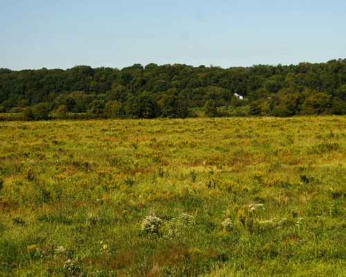
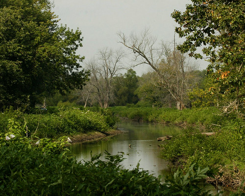
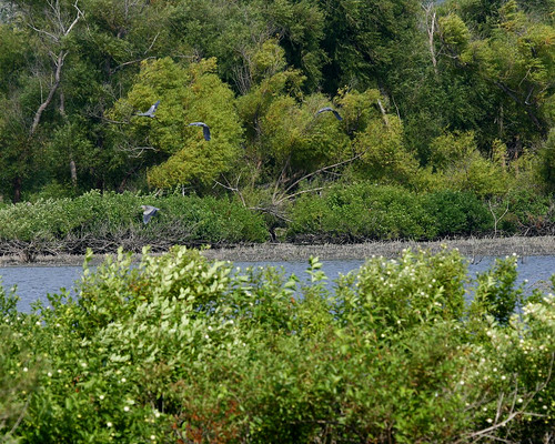
As I reach the small wetland that is forming along a former fence-row ditch, the dominant plant becomes smart weed, now past its prime. Trees left along the fence row provide a break in the prairie and wetland plants.
ClarkRoadWetland10042010JGWard_MG_6375

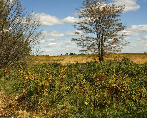
A pond is forming from the seemingly continuously flowing stream.
ClarkRoadWetland10042010JGWard_MG_6377

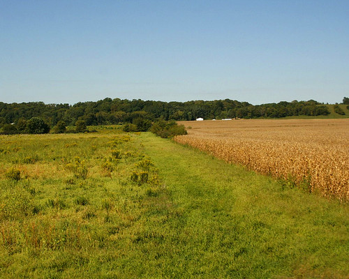
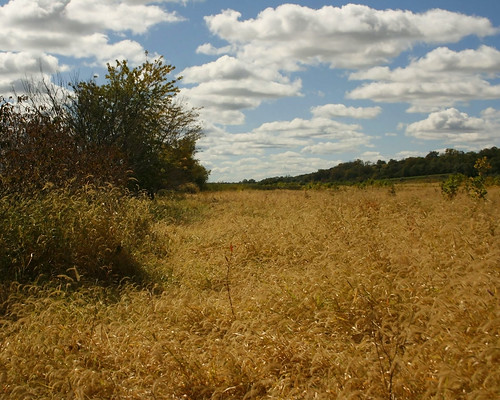
On the higher ground west of the newly forming wetland, Foxtail is the dominant grass, providing a wonderful expanse of golden grain.
ClarkRoadWetlandFoxtails10042010JGWard_MG_6384

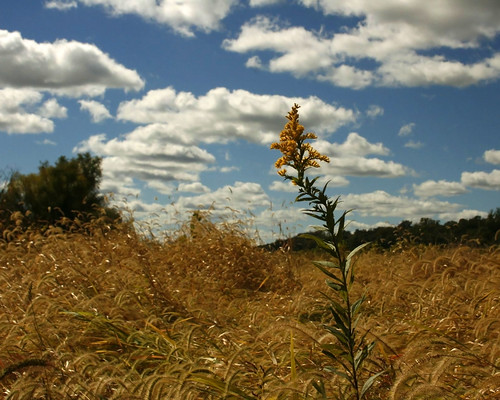
Amid the golden sea of grain, a lone Goldenrod stood proud and tall, a brave move of the Goldenrod into Foxtail habitat in the continuous game of plant succession.
ClarkRoadWetlandGoldenrod10042010JGWard_MG_6403

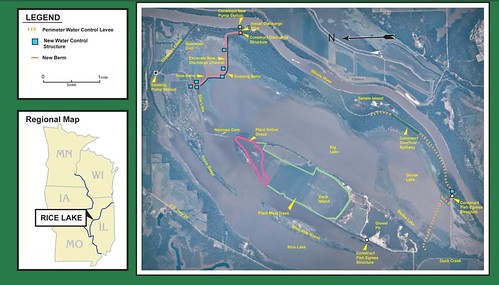
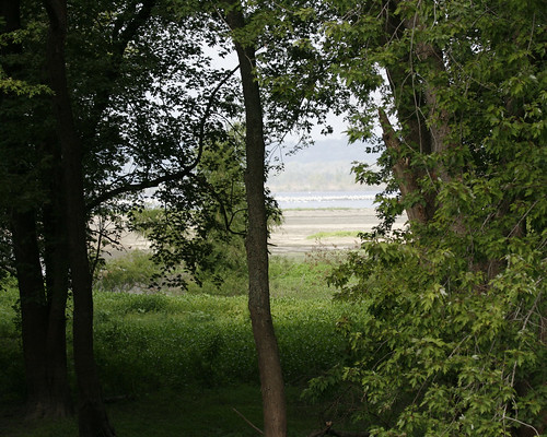
After leaving the path on Clark Road, I drove along the highway and stopped at the Wetland pull-off, one of several pull-offs that lead to former agricultural roads before TNC restored the land.
WetlandPull-offEmiquon10042010JGWard_MG_6482

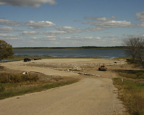
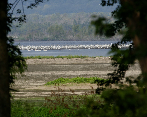
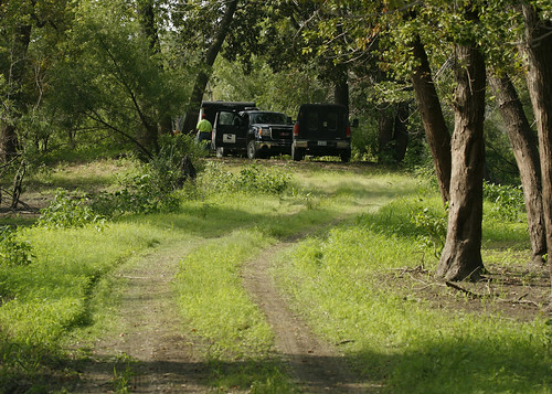
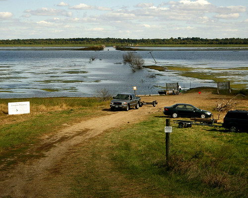
I also stopped at the Pump House Road pull-off, which was temporarily being used as a launch for fishing boats during construction of the new visitor center at the previous launch location.
PumphouseRoadPull-offEmiquon10042010JGWard_MG_6489

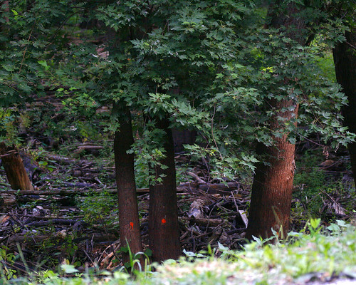
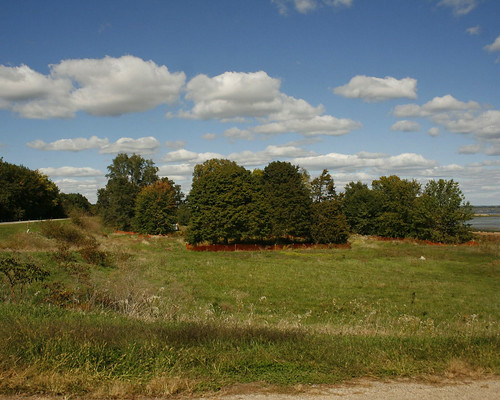
I stopped at the pull-off leading to the former boat launch, which is now a construction zone, and turned to the north to take a photo of the trees that are being saved during the construction. These trees were part of the farm house and buildings during the hundred years the area was drained and farmed.
BoatRampPull-offEmiquon10042010JGWard_MG_6500

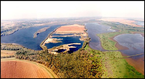
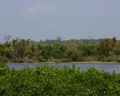
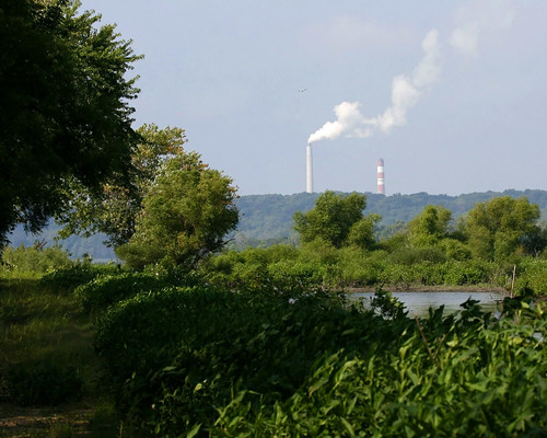
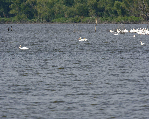
Looking south I could see all the way to Havana, and its giant cloud maker (the power plant).
BoatRampPull-offEmiquon10042010JGWard_MG_6502

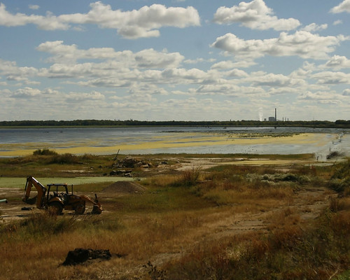
Looking east I could see the transformation taking place at the former boat launch.
BoatRampPull-offEmiquon10042010JGWard_MG_6506

Tuesday, September 14, 2010

Emiquon's Northern Prairie

The prairie on the north side of Thompson Lake has not been restored like the prairie on the west side of the highway. It is a bit ragged, but interesting, with huge areas of Goldenrod juxtaposed against large areas of Foxtail grass. The plant communities change as the land becomes higher and drier or lower and wetter. At one time there would have been a bottom land forest covering the area. TNC has planted a lot of trees on the higher ground, but hasn't done much but some mowing on the land closer to the lake.

TNC property begins with the prairie. The farmland next to it is privately owned.
BetweenCornAndPrairieEmiquonNorthLevee09142010JGWard_MG_3473

As I look across the prairie from the levee, I can see the farmhouse on Clark Road and the trees along the bluff on the west side of the road. In between is a huge expanse of prairie undergoing plant succession, the continuous and fairly predictable change of plant species and communities over time. It is interesting to compare this area with the manipulated prairie west of the highway.
ClarkFarmEmiquonNorthLevee09142010JGWard_MG_3487

From the levee, I can see the prairie as it grows up the bluff and one of the TNC outbuildings on the west side of the highway, four or five miles a way. What a wonderful unobstructed view! On this day in September, the humidity was very low, providing an excellent view.
EmiquonPrairieNorthLevee09142010JGWard_MG_3516

Butterflies and grasshoppers were still abundant in September.
GrasshopperEmiquonNorthLevee09142010JGWard_MG_3845

Common Buckeye Butterfly:
CommonBuckeyeButterflyEmiquonNorthLevee09142010JGWard_MG_3913

Eastern Tailed-blue Butterfly:
EasternTailed-blueButterflyEmiquonNorthLevee09142010JGWard_MG_4041

Black Swallowtail Butterfly:
BlackSwallowtailButterflyEmiquonNorthLevee09142010JGWard_MG_4026

These are just a few of the many things one can see at Emiquon's northern prairie.

Sunday, September 12, 2010

Monarch Migration

Monarchs were migrating through the Emiquon Valley in mid-September.
MonarchMigrationEmiquonClarkRoadPathway09122010JGW_MG_3111

MonarchMigrationEmiquonClarkRoadPathway09122010JGW_MG_3108

MonarchMigrationEmiquonClarkRoadPathway09122010JGW_MG_3093

MonarchMigrationEmiquonClarkRoadPathway09122010JGW_MG_3088

MonarchMigrationEmiquonClarkRoadPathway09122010JGW_MG_3084

Dragonfly Migration

In mid-September, the dragonflies, mostly Green Darners, came through the Illinois River Valley in force. Everywhere I looked there were dragonflies all along the bluff. They moved like a river down the bluffs to the valley. I have never seen so many dragonflies in my life. It was impossible to capture the phenomenon, but I tried!
DragonflyMigrationLA09122010JGWard_MG_3416

DragonflyMigrationLA09122010JGWard_MG_3415

DragonflyMigrationLittleAmerica09132010JGW_MG_3370

DragonflyMigrationLA09122010JGWard_MG_3388

DragonflyMigrationLA09122010JGWard_MG_3391

Thursday, September 02, 2010

Rice Lake -- Let Nature Do It

The Army Corps of Engineers is proposing a more than $11 million project at the Rice Lake State Fish and Wildlife Area along the Illinois River. I really hope they don't go through with the project.

RiceLakePhoto
Cover photo from US Army Corps of Engineers, Rock Island District document: "Rice Lake State Fish & Wildlife Area Habitat Rehabilitation & Enhancement Project"

The project plan includes new river pumps, levees, and water transmission ditches, as well as the planting of 400 acres in trees. In my opinion, planting trees in an area on Duck Island that is currently being farmed is a fine thing to do. However, removing large numbers of trees that eagles use in the winter to roost and in the spring and summer to nest, in order to build levees and drainage ditches and to install large pumps is way too damaging to the environment. The construction would do nearly as much damage, if not more, to parts of this internationally listed migrating bird habitat as it would help.

RiceLakePlan
Illustration from US Army Corps of Engineers, Rock Island District document: "Rice Lake State Fish & Wildlife Area Habitat Rehabilitation & Enhancement Project"

The corps plans to build 2,500 foot spillway that requires them to remove two feet of soil each foot of the length of the spillway, reducing the height to 10.5 feet. Water levels along this part of the Illinois River regularly top that. The plan requires the corps to remove more than 20 acres of mature trees for the levee and channel construction, which will impact bald eagle roosts as well as osprey nesting sites.

Many of the site's existing problems are due to lack of state funds to maintain current equipment and poor management. How will IDNR provide adequate funds for the additional costs of operating four new pumps, ditch and channel maintenance and levee maintenance, estimated at a cost of almost $50,000 annually? This number far exceeds the funds available over the past years for such maintenance.

The goal for this project is to enhance wetland and aquatic habitats. However, the best estimate by the Corps is a success rate of only 30 % for moist-soil plants production over a 10-year period! This isn't success! And it comes at a steep cost to the existing environment.

Construction disturbance for this project is expected to last at least three years, causing disruption to species and habitat loss.

Write IDNR Director Miller and Illinois Governor Quinn and ask them to stop this project before $11 million is spent for a 30% success rate and acres of trees lost in the process.

Tuesday, August 31, 2010

Rice Lake on the Rebound Two Weeks Later

Two weeks after the tour with Bill Douglas and Bill Kapitko, I returned to Rice Lake to see how it was doing without flood waters saturating the land.

Someone has marked trees along the road leading to Copperas Landing, presumably to be removed.
MarkedTreesBannerDikeRoad08312010JGWard_MG_0899

Green carpeted the floors where just 2 weeks ago water was standing. Farther out where mudflats were exposed, a flock of pelicans rested.
PelicansMudflatsBigLakeBannerDikeRoad08312010JGWard_MG_0904

PelicansBigLakeMudFlatsBannerDikeRd08312010JGWard_MG_0907

At the Voorhees Unit, green carpeted the bottomland forest floor. You can see by the high water line on the trees just how deep the water had been in this area for the past several years.
VorheesUnitRiceLakeBannerDikeRd08312010JGWard_MG_0918

BottomlandRiceLakeBannerDikeRd08312010JGWard_MG_0924

I wanted to take a photo of the field where Decurrent False Aster grew several years ago before the high water inundated the area. I parked at the entrance of the Copperas Creek Walk-in Unit. However, as soon as I rounded the bend, I saw an IDNR truck and realized I was blocking their way. As I walked back to my car, a black contractor's truck stopped. The driver told me I needed to move my car, which I was on my way to do. He said he and his team were surveying the area for the Army Corps of Engineers proposed project to revamp the area. I was intrigued. I parked my car well out of the way, and decided to walk out to the Narrows Dam, which I had visited by boat with Bill Douglas and Bill Kapitko just two weeks ago.

As I walked down the path from the road, I spotted a stray Decurrent False Aster. It is a state threatened species, and I am glad to find even a small sample of it after the years of high water the area has endured.
DecurrentFalsAstersRiceLakeCopperasCreekManagementUnit08312010_MG_0899

The water marks on the trees along the path to the Narrows Dam showed how high the water had been before it was released two weeks ago.
CopperasCreekManagementUnitWalkInRiceLakeBottomland08312010JGWard_MG_0953

The surveyors had parked their vehicles out on the levee leading to Slim Lake, where the Corps of Engineers plan to build a canal from a pumping station that they want to build to replace the existing pumps in returning water to the area in the fall.
SurveyorsCopperasManagementUnitRiceLake08312010_MG_0976

I continued walking out to the dam. The canal that I traveled by boat two weeks ago is just as beautiful from the levee road I was walking to the Narrows Dam.
RiceLakePumphouseChannel08312010JGWard_MG_0955

You can clearly see how high the water had been for so long by the lack of leaves on the lower half of the Button Bushes growing between the canal and the levee path.
RiceLakeMudFlats08312010JGWard_MG_0962

A Monarch butterfly posed for me on some blooming Smartweed.
MonarchButterflySmartweedRiceLakeCopperasCreekMgmntUnit08312010JGWard_MG_0975

A Common Buckeye butterfly spread open his wings on the path.
BuckeyeButterflyRiceLakeCopperasCreekMgmntUnit08312010JGWard_MG_0978

Large numbers of Great Blue Herons flew along the edge of Hoaxie Ridge. There were 12-15 herons in all.
HerronsMiserableIslandRiceLakeNarrowsDam08312010JGWard_MG_1021

The path ends at the Narrows Dam. From there I could see former Peoria Mayor Bud Grieves's windmill and the chimney belching water vapor at Duck Creek power plant.
GreivesWindmillRiceLake10312010JGWard_MG_1002

DuckCreekPowerPlantRiceLake08312010JGWard_MG_1003

A family of Wood Ducks swam in the canal near the opening to Rice Lake.
WoodDucksRiceLake08312010JGWard_MG_1011

WoodDucksRiceLake08312010JGWard_MG_1012

A flock of American White Pelicans were gathered far out on the lake.
PelicansRiceLake08312010JGWard_MG_1042

PelicansRiceLake08312010JGWard_MG_MG_1045

A few of them flew over my head, but it was hard to get a decent photo since I was using the mono-pod. It kind of went flying up in the air as I attempted to track the birds. It's a good thing no one was around to get wacked!
PelicansRiceLake08312010JGWard_MG_1052

PelicansRiceLake08312010JGWard_MG_1056