Showing posts sorted by date for query copperas. Sort by relevance Show all posts

Tuesday, August 31, 2010

Rice Lake on the Rebound Two Weeks Later

Two weeks after the tour with Bill Douglas and Bill Kapitko, I returned to Rice Lake to see how it was doing without flood waters saturating the land.

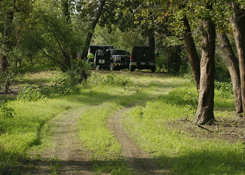
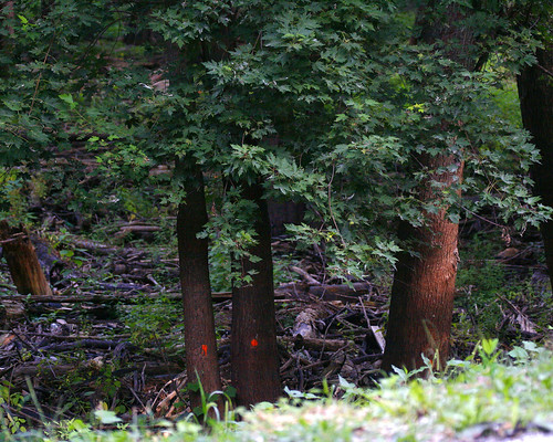
Someone has marked trees along the road leading to Copperas Landing, presumably to be removed.
MarkedTreesBannerDikeRoad08312010JGWard_MG_0899

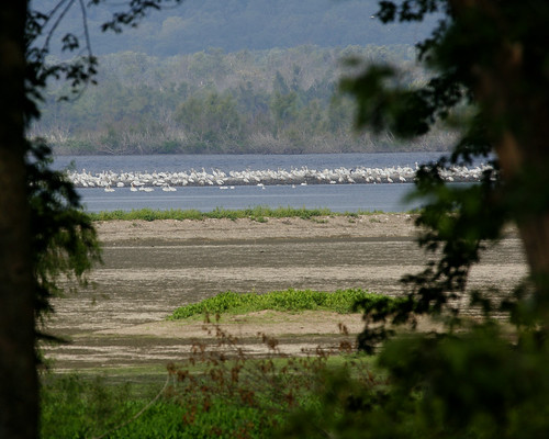
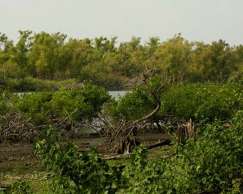
Green carpeted the floors where just 2 weeks ago water was standing. Farther out where mudflats were exposed, a flock of pelicans rested.
PelicansMudflatsBigLakeBannerDikeRoad08312010JGWard_MG_0904

PelicansBigLakeMudFlatsBannerDikeRd08312010JGWard_MG_0907

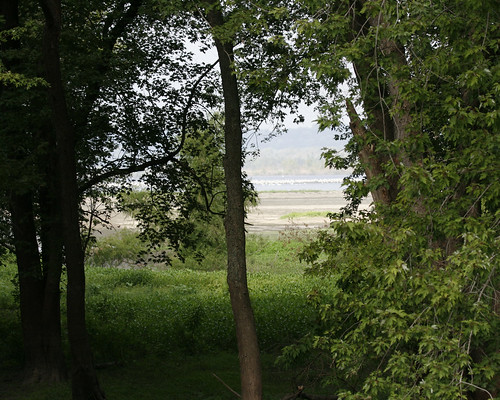
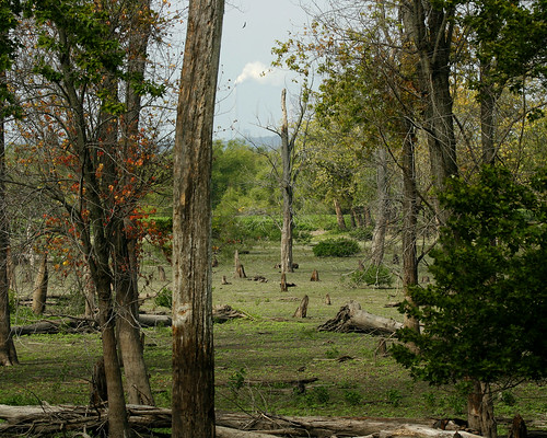
At the Voorhees Unit, green carpeted the bottomland forest floor. You can see by the high water line on the trees just how deep the water had been in this area for the past several years.
VorheesUnitRiceLakeBannerDikeRd08312010JGWard_MG_0918

BottomlandRiceLakeBannerDikeRd08312010JGWard_MG_0924

I wanted to take a photo of the field where Decurrent False Aster grew several years ago before the high water inundated the area. I parked at the entrance of the Copperas Creek Walk-in Unit. However, as soon as I rounded the bend, I saw an IDNR truck and realized I was blocking their way. As I walked back to my car, a black contractor's truck stopped. The driver told me I needed to move my car, which I was on my way to do. He said he and his team were surveying the area for the Army Corps of Engineers proposed project to revamp the area. I was intrigued. I parked my car well out of the way, and decided to walk out to the Narrows Dam, which I had visited by boat with Bill Douglas and Bill Kapitko just two weeks ago.

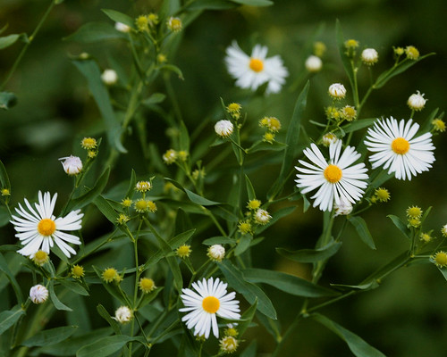
As I walked down the path from the road, I spotted a stray Decurrent False Aster. It is a state threatened species, and I am glad to find even a small sample of it after the years of high water the area has endured.
DecurrentFalsAstersRiceLakeCopperasCreekManagementUnit08312010_MG_0899

The water marks on the trees along the path to the Narrows Dam showed how high the water had been before it was released two weeks ago.
CopperasCreekManagementUnitWalkInRiceLakeBottomland08312010JGWard_MG_0953

The surveyors had parked their vehicles out on the levee leading to Slim Lake, where the Corps of Engineers plan to build a canal from a pumping station that they want to build to replace the existing pumps in returning water to the area in the fall.
SurveyorsCopperasManagementUnitRiceLake08312010_MG_0976

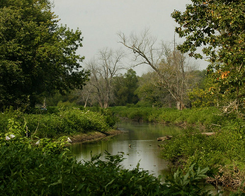
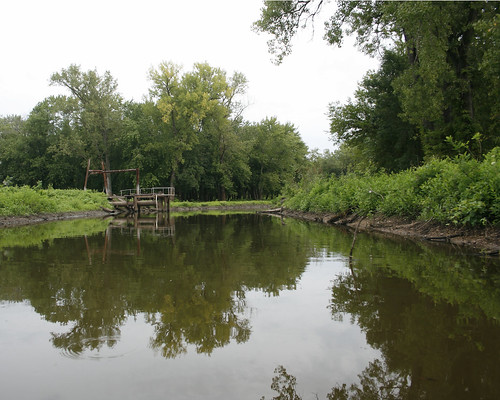
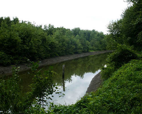
I continued walking out to the dam. The canal that I traveled by boat two weeks ago is just as beautiful from the levee road I was walking to the Narrows Dam.
RiceLakePumphouseChannel08312010JGWard_MG_0955

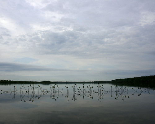
You can clearly see how high the water had been for so long by the lack of leaves on the lower half of the Button Bushes growing between the canal and the levee path.
RiceLakeMudFlats08312010JGWard_MG_0962

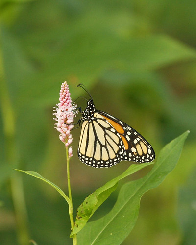
A Monarch butterfly posed for me on some blooming Smartweed.
MonarchButterflySmartweedRiceLakeCopperasCreekMgmntUnit08312010JGWard_MG_0975

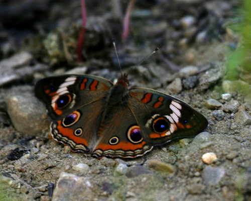
A Common Buckeye butterfly spread open his wings on the path.
BuckeyeButterflyRiceLakeCopperasCreekMgmntUnit08312010JGWard_MG_0978

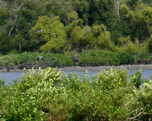
Large numbers of Great Blue Herons flew along the edge of Hoaxie Ridge. There were 12-15 herons in all.
HerronsMiserableIslandRiceLakeNarrowsDam08312010JGWard_MG_1021

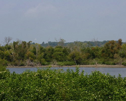
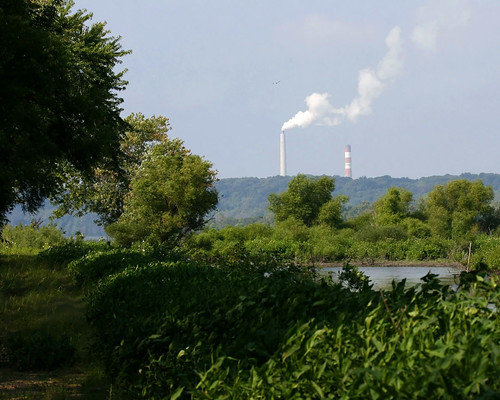
The path ends at the Narrows Dam. From there I could see former Peoria Mayor Bud Grieves's windmill and the chimney belching water vapor at Duck Creek power plant.
GreivesWindmillRiceLake10312010JGWard_MG_1002

DuckCreekPowerPlantRiceLake08312010JGWard_MG_1003

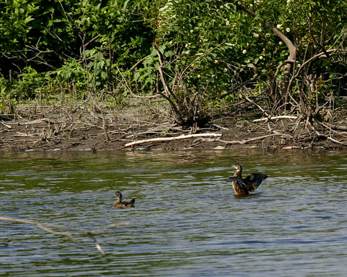
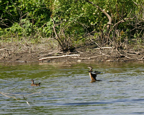
A family of Wood Ducks swam in the canal near the opening to Rice Lake.
WoodDucksRiceLake08312010JGWard_MG_1011

WoodDucksRiceLake08312010JGWard_MG_1012

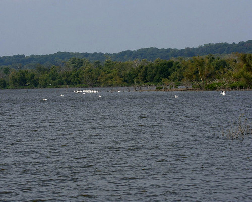
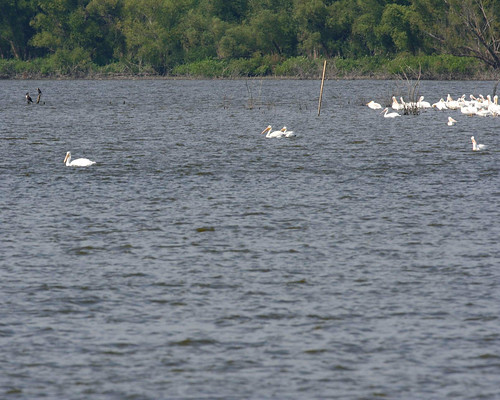
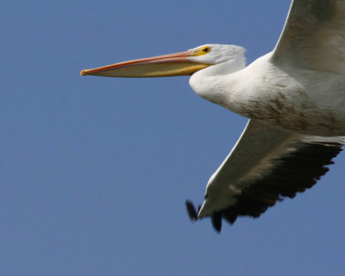
A flock of American White Pelicans were gathered far out on the lake.
PelicansRiceLake08312010JGWard_MG_1042

PelicansRiceLake08312010JGWard_MG_MG_1045

A few of them flew over my head, but it was hard to get a decent photo since I was using the mono-pod. It kind of went flying up in the air as I attempted to track the birds. It's a good thing no one was around to get wacked!
PelicansRiceLake08312010JGWard_MG_1052

PelicansRiceLake08312010JGWard_MG_1056

Tuesday, August 17, 2010

Rice Lake: Letting the Water Out

As one of many people who have enjoyed the Rice Lake State Conservation Area for many years, I have watched the high water remain in the area for the past three years. My friend, Joyce, and I have been concerned about the water's effect on the trees, as well as the lack of habitat for wading and shore birds. On August 17, Bill Douglass, the site manager, and Bill Kapitko, his associate, took us out for a tour of the area to see the water being released into the river.

They took us out on the lake and showed us the Narrows Dam, which was open. Water from Rice Lake flowed into Big Lake through the openings. At this time, Rice Lake was almost level with Big Lake.
RiceLakeNarrowsDamOpen08172010JGWard_MG_9102

STOPLOGSTRUCTUREBigLake08172010JGWard_MG_9112

RiceLake08172010JGWard_MG_9094

Asian Carp flew up out of the water and into the boat as we crossed the lake.
RiceLakeCarpBillDouglassBillTopinkoJoyceBlumenshine08172010JGWard_MG_9134

We rode down the channel that leads from Rice Lake to the pump house.
RiceLakePumphouseChannel08172010JGWard_MG_9123

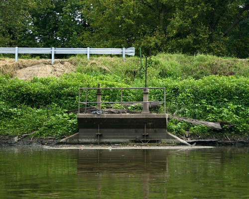
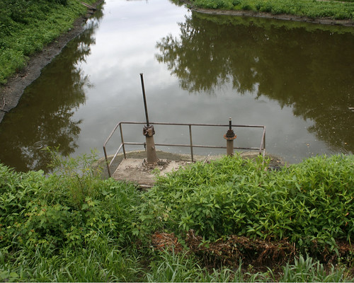
The valves on the gatewell structure keeping water in the channel had been opened. One valve would only partially open, but the other valve was completely open, allowing water to flow into the creek from the Rice Lake.
GatewellStructureRiceLakePumpHouseChannel08172010JGWard_MG_9129

After the ride on the lake, we followed them to Copperas Landing to go out on the river. We stopped by the pump house on our way to the landing.

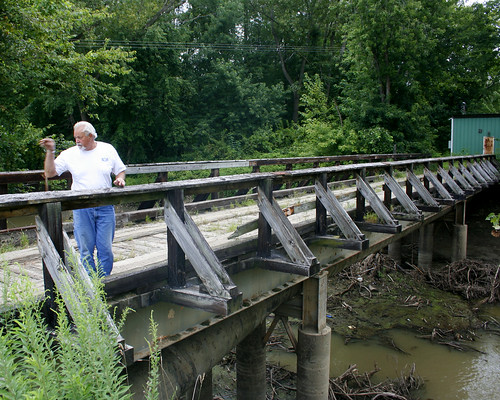
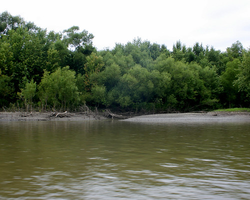
Bill Douglass stopped on the bridge over Copperas Creek that leads to the pump house. He explained how under normal river levels, the IDNR lets water out of the compound in the early summer, when the river goes down. Then they pump water back into the area in the fall in preparation for waterfowl hunting.
RiceLakePumphouseBridgeBillDouglass08172010JGWard_MG_9139

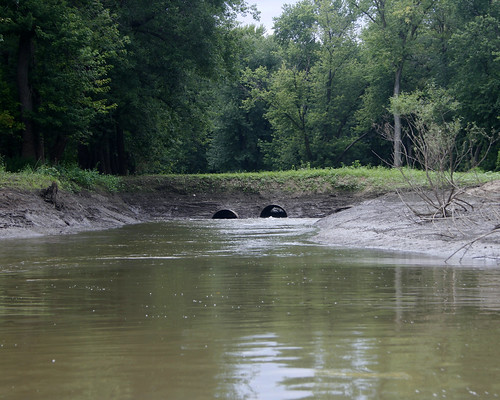
The large tubes under the bridge bring water into the channel when the pumps are working.
RiceLakePumphouseBridgeCopperasCreek08172010JGWard_MG_9138

The pumps bring water from this channel, which is privately owned and which has many siltation problems.
ChannnetToPumpHouseRiceLake09172010JGWard_MG_9144

The valves of the gatewell structure were open, and the water from the channel flowed into the creek. This is the first time in several years that water has been released from the compound.
RiceLakeWaterEgressValves08172010JGWard_MG_9137

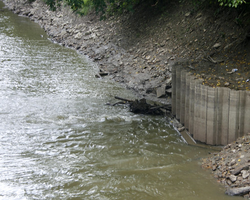
Looking down Copperas Creek from the bridge, we could see the water bubbling up as it flowed through the structure.
CopperasCreekRiceLakeEgress08172010JGWard_MG_9140

RiceLakeWaterEgressCopperasCreek08172010JGWard_MG_9141

We stopped at the Voorhees Unit, where water was flowing through the water control structure into a channel leading to the river.
VoorheesUnitWaterControlOpen08172010JGWardMG_9147

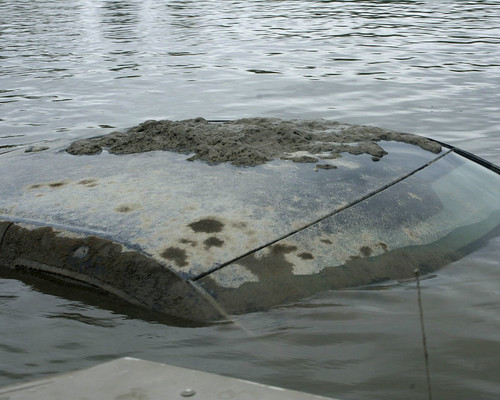
Bill took us out on the river to view the water leaving the area through other outlets. We hadn't gone far from the landing before we spotted an antennae sticking out of the water; it was attached to a submerged pickup truck. Bill called the local rescue team. They were still working on getting the truck from the river when we returned from our river ride. I never did find out what the story was with the truck.
SubmergedPickupTruckIllinoisRiver08172010JGWard_MG_9160

We passed the West River, the small stream separating Senate Island, which is privately owned, from the land surrounding Big Lake.
WestRiverSenateIslandIllinoisRiver08172010JGWard_MG_9172

Bill stopped by the Stoplog structure, from which water flowed freely into the river.
StopLogStructureBigLake08172010JGWard_MG_9178

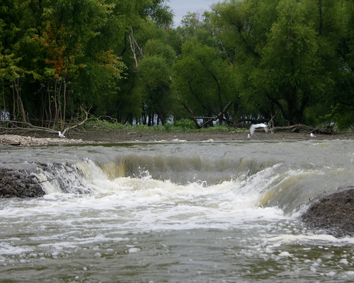
We ended the tour at the Woodyard Slough, were water flowed over the Hate Levee (so called because of the many fights between area gun clubs over water rights).
HateLeveeOverflowWoodyardSlough08172010JGWard_MG_9195

HateLeveeOverflowWoodyardSlough08172010JGWard_MG_9197

Friday, January 09, 2009

Public Hearing Jan 23 Changes to Illinois List of Threatened and Endangered Species

As outrageous as it is, the Illinois Endangered Species Protection Board is proposing to delist the American Bald Eagle from the list of Threatened Species in Illinois! Will they never stop developing the little land that is left for birds in this state? I'm outraged.

In addition to delisting Bald Eagles, they plan to delist Henslow's Sparrow, and Sandhill Cranes.

And, get this, they are going to change Mississippi Kites from Endangered to Threatened, because:

"This species appears to be increasing and expanding its range slightly within the state. The population appears to be too secure to be considered Endangered."

Are you kidding me? This is totally insane.

It is our IDNR being run by people who only consider developing our resources, not protecting them. Illinois has very few natural areas left, which these species need. These proposed changes will make it easier for developers to come in with their huge Caterpillar machines and destroy the trees, like they are doing at Copperas Landing to put in a pumping station for the Canton pipeline going in along Banner Dike Road.

What can we do as citizens, you ask?

Well we can do a lot, I have found. We just need to get involved as citizens and make our voices heard. The time frame for this is very short. They count on us not knowing about it in time to make a difference.

This time we do know about it in time. Let's make a difference.

Please come to this hearing prepared to give comments, up to 5 minutes, regarding why the status of these birds should not be changed.

Then follow up with detailed written comments. If you cannot attend the hearing, please send comments to the board regarding why these birds need to be protected.

We missed the boat on this part of the process for issuing the mining permit in Banner. Let's not miss this opportunity to be heard by the Endangered Species Protection Board.

http://www.dnr.state.il.us/espb/index.htm

ANNOUNCEMENT of PUBLIC HEARING
The Illinois Endangered Species Protection Board will hold a public hearing at 12:00 p.m. on Friday, January 23, 2009 at the Illinois Department of Natural Resources headquarters building (Lakeview Conference Room C), One Natural Resources Way, Springfield, Illinois to take public comments on proposed changes to the Illinois List of Threatened and Endangered Species.

This hearing will be accessible to handicapped individuals in compliance with all pertinent state and federal laws, upon notification of anticipated attendance. Handicapped persons planning to attend and needing special accommodations should contact the Endangered Species Protection Board at 217/785-8687 (TTY 217/782-9175) prior to the hearing to inform of their anticipated attendance.

BIRDS

Ammodramus henslowii (Henslow’s Sparrow) – Proposed Action: remove from threatened. The number of locations in the Natural Heritage Database for Henslow’s sparrows continues to increase. The recently completed recovery outline for this species recommends consideration for removal from the state list when, within the last five years, there are records in the Natural Heritage Database from 40 or more Illinois counties, and 10 or more populations numbering 20 or more breeding pairs within protected habitats. The county threshold has been met (46 counties between 2002-2006) and the protected populations criteria has also been met.

Grus Canadensis (Sandhill Crane) – Proposed Action: remove from threatened. The population within the state continues to increase and is also establishing occurrences outside of northeastern Illinois. Recent analyses of data from the Northeastern Illinois Wetland Bird Survey indicate a significantly increasing population in the northeastern portion of the state.

Haliaeetus leucocephalus (Bald Eagle) – Proposed Action: remove from threatened. This species appears to be doing very well in the state, the number of records in the Natural Heritage Database continues to go up as does the number of counties from which the species is known to occur in Illinois. Winter surveys are showing good numbers of immatures, indicating a healthy age structure.

Ictinia mississippiensis (Mississippi Kite) – Proposed Action: change status from endangered to threatened. This species appears to be increasing and expanding its range slightly within the state. The population appears to be too secure to be considered Endangered.


PUBLIC HEARING January 23, 2009

Changes to Illinois List of Threatened and Endangered Species

1. Call to Order (Hearing Officer, Secretary, Chris Phillips)
2. Introduction of Board members and staff
3. Opening Statement (Director, Anne Mankowski)
4. Public Comments (chaired by Hearing Officer, Secretary, Chris Phillips)

Instructions:

A) Registration Form

1) Everyone should fill-out and return form to the front of the room (before hearing starts).
2) Indicate if you wish to comment.

B) Oral Comments:

1) We will call on you, using your registration form (in the order turned in).
2) Come to the front of the room to speak.
3) Give your name and affiliation, if any.
4) Limit comments to 5 minutes each.
5) We will only accept comments on the topic of the changes that the Board has proposed to the Illinois List of Threatened and Endangered Species; if you wish to discus any other matters, we will be happy to talk to you at another time.
6) We are here to listen to comments from the public, not to engage in debate regarding any of those comments.

C) Written Comments:

1) The hearing record will remain open for 14 days
2) Submit written comments to:

Illinois Endangered Species Protection Board
One Natural Resources Way
Springfield, IL 62702-1271

Or e-mail comments to: dnr.espb@illinois.gov

3) ALL comments must be received by the Board on or before February 6, 2004.
Sunday, January 04, 2009

Copperas Landing and Banner Dike Road

Yesterday, on the 4th day of the new year, Scott and I drove down to Banner. The mess left at the landing by the pipeline/pumping station construction is still there. Huge trees lying on their sides. The machines that pushed them down parked near by.
CopperasLandingBannerDikeRd01032009JGWard_MG_7948
CopperasLanding01032009JGWard_MG_7940
CopperasLandingBannerDikeRd01032009JGWard_MG_7943

The entire area leading out to the landing, including the proposed mining site, is under water.
BannerDikeRd01032009JGWard_MG_7971

There is a cofferdam in the ditch by the road:
CofferdamsBannerDikeRd01032009JGWard_MG_7974

The levee on the south side of Morgan Ditch is under water.
MorganDitchBannerDike01032009JGWard_MG_7964

Two hawks flew together from one snag to another.
TwoHawksBannerDike01032009JGWardIMG_8935

But the most exciting find was a pair of Brown Creepers whistling in the trees a long the road on the proposed Banner Mine site! Brown Creepers are threatened in Illinois. The trees on the mining site provide an ideal habitat. And now we know they are present on that site!
BrownCreeperBannerDike12302008IMG_8802

Thursday, December 18, 2008

Trees Downed at Copperas Landing

The city of Canton is putting in a water line along Banner Dike Road. They have done much damage to the trees along the dike, which is very disheartening for the wildlife in the area. However, I never dreamed of the destruction that would take place among the huge old Cottonwood Trees along the river. I took these photos last month, on November 22, 2008. I plan to go back to photograph the rest of the destruction sometime next week.

CopperasLandingTrees11222008JGWard_MG_7790
CopperasLandingTrees11222008JGWard_MG_7796
CopperasLandingTrees11222008JGWard_MG_7803
CopperasLandingTrees11222008JGWard
While there that day, we found an eagle in one of the remaining large trees, and it makes me so sad to think of the loss of habitat for these majestic birds.

EagleBannerDikeRd11222008JGWardIMG_8220
EagleBannerDikeRd11222008JGWardIMG_8221
EagleBannerDikeRd11222008JGWardIMG_8222